Major Goals
One of the major impacts of our work has been our ability to be agile in response to landslide events. In Fall 2022, we applied for and received a RAPID award, to examine the impacts following Hurricane Fiona. The proposal, Collaborative Research: RAPID: The fate of landslide-derived sediment following tropical cyclones: a case study of Hurricane Fiona in Puerto Rico, had 2 major goals:
- make time-sensitive measurements of perishable landforms and deposits from Hurricane Fiona before they were eroded or overgrown
- investigate how hurricanes transform river channels through landslide and flood processes.
Accomplishments
Goal 1: Measurements of perishable landforms and deposits targeted six locations in two adjacent river systems in central Puerto Rico, the Rio Caonillas and Rio Cerrillos. We also collected preliminary data from the Rio Coamo. We returned to each of the six sites in October 2022, November 2022, January 2023, March 2023, October 2023 and December 2023, some sites had additional visits from UPRM colleagues between trips. Both GT and UPRM students and faculty participated in nearly all field work (except some trips with just UPRM students).
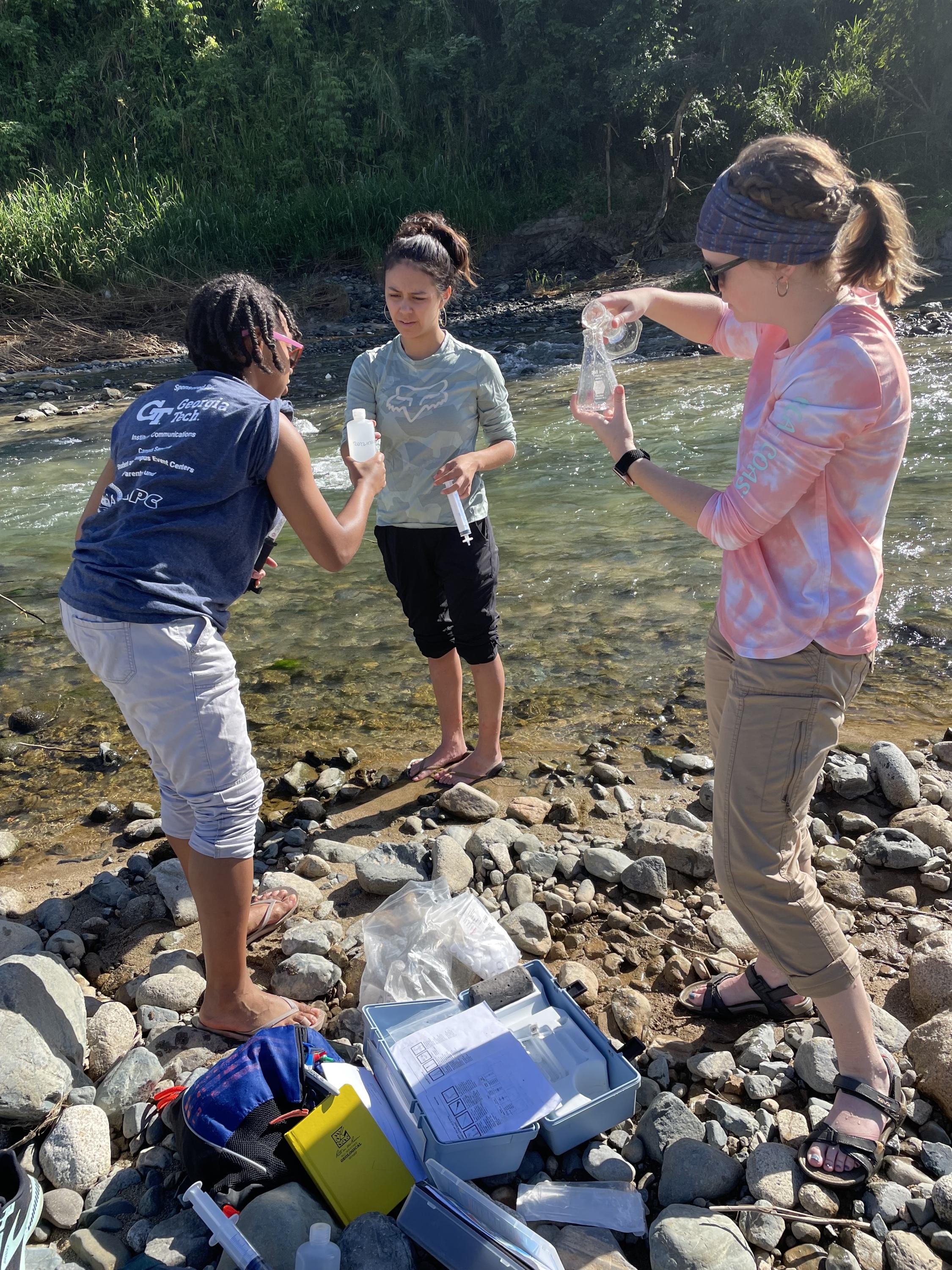
We collected sediment samples for cosmogenic radionuclide measurements (both quartz for 10Be and magnetite for 36Cl measurements) and water samples for aqueous geochemistry (alkalinity, TDS, cation concentration) from each of the six locations. Sampling was repeated for most sites during each field season, resulting in approximately 30 total sample sets. Of these sample sets, 11 sediment samples were sent to the Purdue PRIME lab where they currently await analysis. We also conducted particle size analysis at each sampling site using a gravelometer and subsampled fine sediment areas for laboratory particle size analysis with a Partan3D. We measured major cation concentration of nearly all water samples via ICPMS at Georgia Tech.
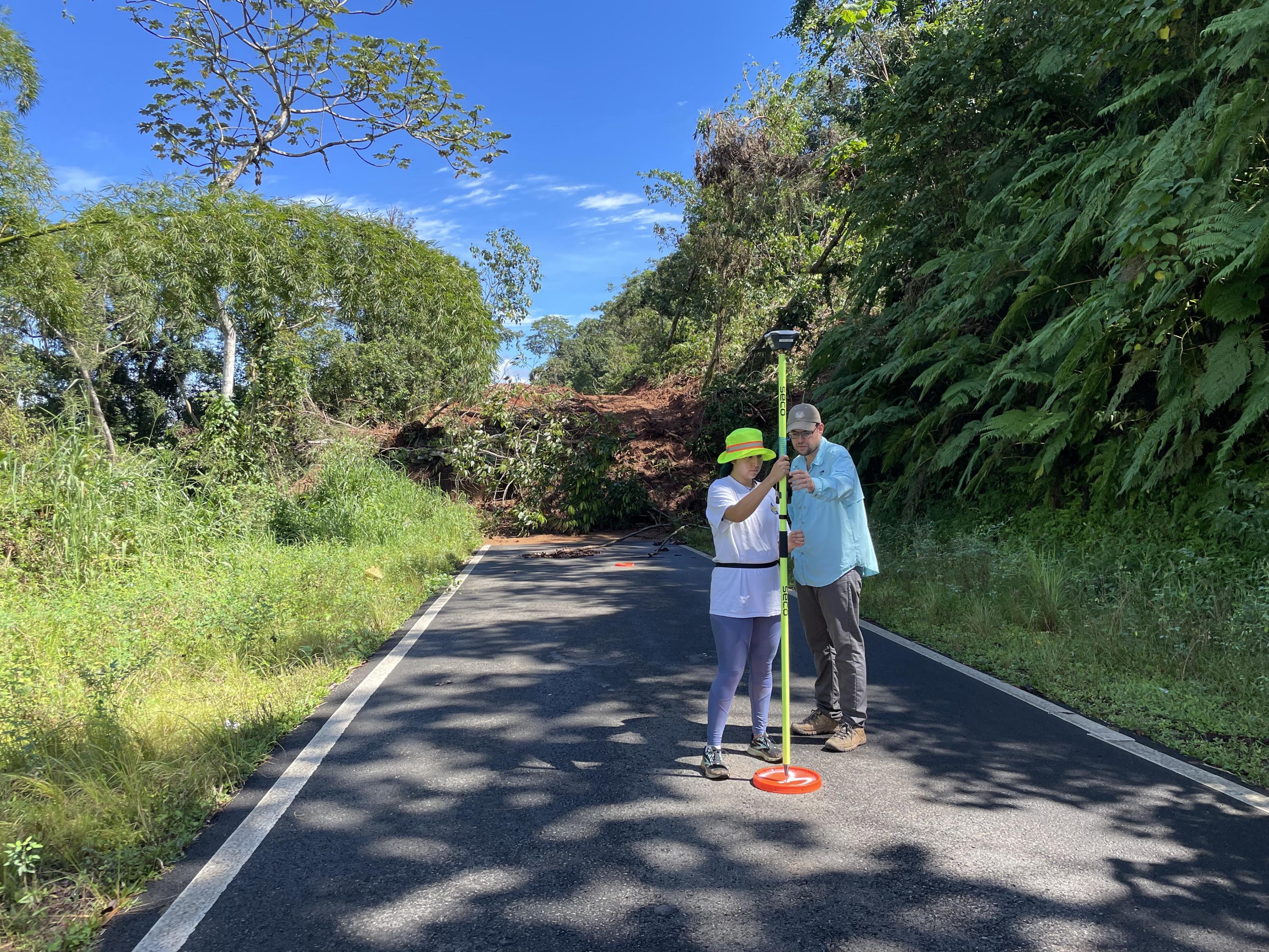
Water sample analysis was not originally proposed, but was completed opportunistically and was complimentary to the sediment samples. We conducted drone surveys of river channels and adjacent banks at each of the six locations as well as several active and recent landslides within the contributing area of the Rio Cerrillos and Rio Caonillas. We also collected preliminary surveys from the the Rio Coamo. Drone surveys were designed to collect images for structure-from-motion photogrammetry. Surveys were repeated at least four times at each site, resulting in 28 total point clouds. We were typically able to achieve better than 10 cm per pixel resolution for elevation products (e.g. DEMs) derived from point clouds. Surveys also included ground control points for geospatial referencing and validation.
We installed seven time-lapse cameras across the six locations, with one location having a duplicate camera. Despite some logistical issues with the cameras, we were able to collect daytime images at 5 minute intervals from all six locations for a majority of the time period spanning 11/19/22 to 12/08/23. Some time gaps occurred when cameras malfunctioned, termite infestation, waterlogging and theft were among the logistical issues. Nearly all cameras required replacement at some point during the year.
Goal 2: We investigated how landslides and flooding transform rivers in Puerto Rico with a combination of time-series analyses and numerical modeling. This work benefitted from the participation of two Georgia Tech undergraduates independently supported by a small internal grant and one visiting student supported by an NSF REU Site awarded to Georgia Tech (#1852040). Additional analytical work was completed by one MS and four undergraduate students at UPRM.
Time series analysis included: point-cloud differencing of photogrammetric point-clouds and analysis of time-lapse images. We compared point-clouds from a pre-Fiona LiDAR dataset, and surveys immediately after the event (October and November 2022) 6 months after (March 2023) and one year after (October 2023). We performed model alignment and differencing in CloudCompare, and exported gridded maps of net erosion/deposition for the surveyed reaches.
We scaled and rectified time-lapse photographs using OpenCV, then extracted information on particle size and river stage from image sets. We are currently working to integrate point cloud and time lapse images to improve time-lapse image calibration.
We also developed a numerical model of bedload transport and abrasion to predicted downstream fining. We were able to extract coarse sediment (e.g. > 10 cm size fraction) size distributions from point-clouds and measure downstream fining of the coarse sediment fraction. Model inputs are primarily a frequency/magnitude discharge relationship and an initial particle size distribution. Model outputs are a particle size distribution as a function of downstream distance.
Key Outcomes
Our primary conclusion is that hurricanes are the dominant mechanism of sediment transport in the mountain rivers of Puerto Rico. This conclusion is supported by a timeseries study of rivers effected by landsliding and flooding during Hurricane Fiona. In the year following the event, sediment transport was reduced and restricted to suspended load. We estimate that a majority of the annual sediment budget, and nearly all of the coarse bedload sediment was transported during a single event: Hurricane Fiona. Hurricane Fiona reshaped mountain rivers by widening them and introducing channel roughness features like coarse bedload sediment and large-scale bedforms.
The dominance of hurricanes in shaping Puerto Rican rivers has important implications for predicting future flooding under a warming climate. If the frequency and/or magnitude of hurricanes increases, we anticipate a reduced rate of downstream fining, which means coarse landslide-derived sediment accumulates in river channels, increasing channel roughness and reducing the cross-sectional channel area – both of which act to reduce the ability of the river to transport water a sediment and increasing flood potential.
To improve the accuracy of future flood predictions, we also discovered that the historical discharge record from river gauges underestimates the impact of large flood events – possibly because they are too infrequent, or even absent in the gauge records. Palaeohydrological reconstruction of past hurricane events (e.g. from sedimentary archives) is critical to constraining the true frequency/magnitude discharge relationship for Puerto Rican rivers.
This research resulted in release of a technical hazard report in collaboration with the NSF-supported GEER (Geotechnical Extreme Events Reconnaissance) program. Results were also presented in two student-led presentations at the 2023 AGU Fall Meeting. Finalized datasets have been submitted to publicly accessible online databases and in-process data will be added when complete.
This research acted as a mechanism for GT and UPRM to coordinate with an NSF-supported Collaborative Center for Landslide Geohazards to present and lead sessions at two conferences: the ASABE Soil Erosion Research Under a Changing Climate conference in Aquadilla, PR and the AGU Fall Meeting in San Francisco.
This research supported the full participation of four graduate and three undergraduate students from Georgia Tech, one graduate and five undergraduate students from UPRM – all students from groups traditionally underrepresented in the geosciences. Computational work also included two Georgia Tech undergraduates, a visiting REU student and five URPM students. Students and faculty led a Spanish-language outreach event to teach elementary school students about landslide hazards at a school nearby one of our survey sites.
Opportunities for Professional Development/Training
Despite not allocated funding specifically for student stipends of faculty salary, this project produced a multiple opportunities for training and professional development. Fieldwork supported training of four graduate and three undergraduate students from Georgia Tech, one graduate and five undergraduate students from UPRM. Computational work further supported training of two Georgia Tech undergraduates, a visiting REU student and five URPM students. Two Georgia Tech undergraduates and three Georgia Tech graduate students also attended the 2023 AGU Fall meeting, and one graduate student participated in the mentoring program at the conference.
Results for Community
Results have been presented in two presentations at the 2023 AGU Fall Meeting and are currently being finalized for publication. Photogrammetric point clouds have been submitted to the online OpenTopography database for public access and geochemical data will be archived in ICE-D as it comes available. The GEER technical report is also available for public access on the GEER website and has DOI: 10.18118/G6Z38B. This research also allowed GT and UPRM to meet directly with stakeholders in Puerto Rico during the ASABE Soil Erosion Research Under a Changing Climate conference in Aquadilla, PR. This conferences hosted multiple listening sessions organized by the the NSF-supported Collaborative Center for Landslide Geohazards.